


Uncovering the Threat: Satellite Mapping Reveals Hidden Fault Beneath Canada that Could Trigger a 7.5 Magnitude Earthquake
Scientists in Canada have evaluated novel satellite and lidar mapping data and found that an unsuspected fault lies hidden beneath the surface, posing a significant earthquake risk. This discovery sheds light on the importance of advanced technologies in identifying potential geological hazards that could have far-reaching consequences.
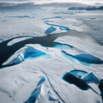
The study, conducted by a team of geologists and seismologists, utilized cutting-edge satellite imaging techniques to analyze the Earth’s surface in unprecedented detail. By combining data from multiple sources, including synthetic aperture radar and light detection and ranging (lidar), researchers were able to create a comprehensive map of the region, revealing the presence of a previously unknown fault line.
Located deep beneath the surface, this hidden fault stretches for miles and shows signs of active tectonic movement. The data indicates that stress has been building up along the fault line, increasing the risk of a major seismic event. In fact, scientists estimate that the fault has the potential to generate an earthquake with a magnitude as high as 7.5 on the Richter scale.
While the exact timing of such an event remains uncertain, the implications are clear. An earthquake of this size could have devastating effects on the surrounding area, impacting infrastructure, communities, and the environment. It underscores the need for proactive measures to prepare for and mitigate the risks associated with seismic activity.
In response to these findings, local authorities are working to enhance their emergency preparedness and response plans. By incorporating the latest scientific data into their risk assessments, they aim to better understand the potential impact of a major earthquake and develop strategies to protect lives and property.
Moreover, the research highlights the critical role that technology plays in modern geoscience. Satellite mapping, in particular, has revolutionized the way we study the Earth’s surface, providing detailed insights that were previously inaccessible. By harnessing the power of these advanced tools, scientists can uncover hidden geological features and better predict natural disasters.
As our understanding of the Earth’s dynamics continues to evolve, so too must our approach to managing geological risks. The ability to identify potential hazards, such as the hidden fault beneath Canada, empowers us to take proactive steps to safeguard vulnerable regions and populations. Through ongoing research and collaboration, we can work towards a safer and more resilient future in the face of natural threats.
In conclusion, the revelation of a hidden fault capable of triggering a 7.5 magnitude earthquake serves as a stark reminder of the unpredictable forces at play beneath our feet. By leveraging innovative technologies and interdisciplinary expertise, we can better prepare for the unexpected and build a more secure tomorrow.
earthquake, Canada, fault line, satellite mapping, seismic risk